The right way to open a New Zealand journey.
The Twin Coast Discovery Highway.
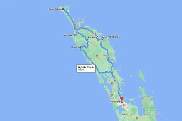
It’s an 800-kilometer loop starting and ending in Auckland, threading through Northland. One road touching two coasts — east and west. No rush, just the steady pull of beaches, forests, and quiet bays.
You’ll drive it clockwise or counterclockwise. Most go north first, up the east side, then back down the west. Either way, it’s about noticing the shifts: from rolling hills to ancient kauri trees, dolphins in the bay to sand dunes at the tip.
Best time? Summer, December to February, for warmth and longer days. But I’ve driven it in shoulder seasons — fewer cars, same views. Winter brings rain, so pack layers.
Vehicle: A campervan handles it well, or a standard car if you’re day-tripping stops. Roads are sealed, but some stretches wind narrow. Fuel up in towns; stations thin out north of Whangarei.
Data on the road: Spotty in remote spots. An eSIM like ANZroam.com keeps you connected without surprises — I’ve used it to check tides or book a ferry on the fly.
Route Breakdown.
Start in Auckland. Head north on State Highway 1 to Whangarei — about two hours. Easy drive, traffic eases after the city. Whangarei has cafes and a harbor walk if you need a break.
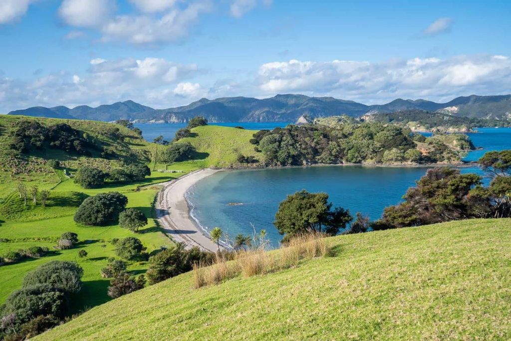
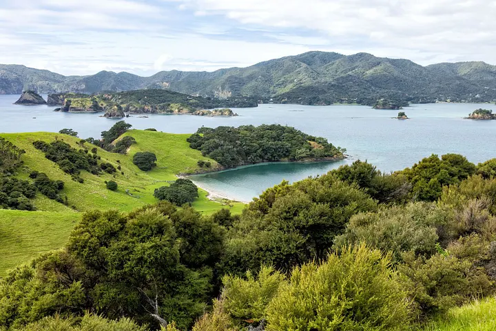
From there, east coast leg: To Paihia in the Bay of Islands. Another hour or so. The bay’s dotted with 144 islands — cruises spot dolphins, or kayak if you’re up for it. Waitangi Treaty Grounds tell the history without fanfare.
Push to Kerikeri — orchards and old stone stores. Fresh fruit from roadside stalls. Then north to Cape Reinga, the tip where Tasman Sea meets Pacific. The lighthouse stands quiet; walk the path, feel the wind.
Cross to the west coast. Ninety Mile Beach — actually 55 miles, but who’s counting. Drive it if tides allow, but check conditions; vehicles get stuck.
Down to Waipoua Forest. Giant kauri trees, Tane Mahuta the largest — 2,000 years old. Pull over, walk the short track. The air’s cooler here, mossy.
Then Hokianga Harbour — raw, less polished than the east. Opononi for sandboarding dunes. Back south through Dargaville, kauri museums if that interests you. Ends looping to Auckland via Brynderwyn Hills — watch for curves.
You can rush it. Most people do. But the road doesn’t reward speed.
Full loop: 5–7 days comfortable. I’ve stretched it to 10, lingering.
Stops That Matter.
Bay of Islands: Boat tour from Paihia. Dolphins often show; no guarantees, but worth the wait.
Cape Reinga: Sunrise or sunset. The meeting of seas churns below.
Waipoua Forest: Night walks for glowworms if you camp nearby.
Hokianga: Ferry across the harbor saves time, adds a view.
Beaches: Tutukaka for diving, Matapouri for mermaid pools.
Eats and Stays.
Local: Fish and chips in Paihia, kumara in the north. Cafes in Kerikeri do good coffee.
Campgrounds plentiful — freedom camping restricted, so book sites. Motels in towns, or Airbnbs for quiet. I’ve parked vans at DOC sites; basic, but stars overhead.
Practical Notes.
Speed limits: 100 km/h open road, slower in towns. Kiwis drive left — easy to forget at roundabouts.
Weather: Changes fast. Rain slicks roads; sunsets make up for it.
Wildlife: Kiwi birds nocturnal, but signs warn of them.
Costs: Fuel around $2–3/liter in 2026. Ferries $20–50. Entry fees minimal.
It’s not about ticking boxes. The road unfolds, coasts on both sides. Drive steady, pull over when something catches your eye.
If you hit a flat or lose signal, locals help. That’s the way it goes up there.
Travel smart. Stay connected.