A central spine through the North Island’s volcanic heart. From Auckland south to Hawke’s Bay, mostly along State Highway 1 and 5. Steam rises from the ground, lakes fill old craters, mountains stand sharp against the sky.
I’ve driven it north to south and back. Summer brings clear days for hikes, winter fog in the valleys. Roads are good — sealed, busy near towns, quieter in between. A week gives it breathing room; rush it and the details blur.
Day 1: Auckland to Waitomo (200 km, 3 hours).
Flat at first, then rolling hills. Waitomo’s caves wait underground — glowworms light the dark like stars on a boat ride. Book ahead; tours fill.
Day 2–3: Waitomo to Rotorua (150 km, 2 hours).
Geothermal starts here. Rotorua smells of sulfur — takes getting used to. Geysers erupt on schedule at Te Puia, mud pools bubble at Wai-O-Tapu. Walk the boards; steam warms the air.
Evening soak in hot pools if your stay has them.
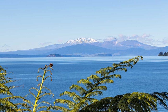
Day 4–5: Rotorua to Lake Taupō (80 km, 1 hour).
Short drive, big lake. Taupō sits in a caldera — water clear, mountains across. Boat to carved rocks or just sit shoreside. Huka Falls roars nearby.
Day 6–7: Taupō to Tongariro National Park and south (100 km to park, then to Hawke’s Bay).
Tongariro’s volcanoes dominate. The Alpine Crossing — one day, 19 km, climbs over craters and emerald lakes. Weather turns fast; check forecasts, go guided if unsure.
From there, south to Napier — vineyards appear, coast nears.
Practical sides.
Fuel in towns; geothermal areas thin services. Data spotty in parks — an eSIM like ANZroam loads weather updates without hunting bars.
Layers for altitude, sturdy shoes for walks. The ground steams, but the road stays steady.
It’s a drive where the land reminds you it’s alive. No need to chase drama — it rises on its own.