A full circle around Tongariro National Park. Roughly 150 kilometers. State Highways 47, 4, 49, and 1, starting and ending in Tūrangi. One road that keeps changing its mind — forest one minute, barren volcanic plain the next, then back to alpine tussock. The Desert Road stretch (SH1) is the one everyone remembers: stark, empty, and suddenly massive when Ruapehu shows itself.
I’ve driven it in every season. Summer for long daylight and open trails. Winter when snow dusts the volcanoes and the road can close without warning. Either way, check the forecast twice. Weather here doesn’t ask permission.
Day-by-day, loose and flexible.
Start in Tūrangi. Small town, solid base. Fuel, groceries, last decent coffee before the loop tightens. Head north on SH47 toward Whakapapa Village. The road climbs gently at first, then the bush gives way to open views of Ngauruhoe — perfect cone, still smoking on quiet days.
Whakapapa. Ski field in winter, base for summer walks. Short stroll to Taranaki Falls if you’re not hiking big. Or just sit with the mountain filling the windscreen. No need to rush.
Continue on SH48 (Bruce Road) if you want the village proper, then backtrack to SH47 and swing west toward National Park village. This side feels quieter. Podocarp forest thick, occasional glimpses of the trio of volcanoes through the trees.
National Park village. Junction point. Good cafes, a few motels. Turn south onto SH4. The road drops toward Taumarunui, then curves east on SH49 toward Waiouru. Less dramatic here, but the light changes fast — shadows stretch across the plain.
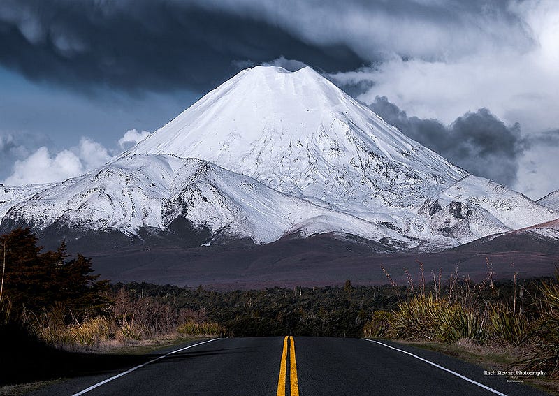
Then the Desert Road (SH1 south). This is the stretch that earns the name. Wide, straight, almost lunar. Rangipo Desert on your left, Ruapehu rising ahead. Pull over anywhere safe. The silence is loud. I’ve stood here at dusk with no other cars in sight for twenty minutes. Nothing moves except the wind and your own breathing.
Waiouru. Army town, cold in winter. Turn west on SH49 back toward Tūrangi. The road follows the southern edge of the park — rolling farmland now, but Ruapehu stays in the rear-view the whole way.
Full loop: 3–5 hours driving without stops. Realistically, stretch it over 2–3 days. Overnight options: Whakapapa (DOC huts or lodges), National Park village, or back in Tūrangi.
Practical notes that actually matter.
Roads are sealed and well-maintained, but narrow in places and prone to ice or snow above 800 meters. SH1 Desert Road closes regularly in winter — sometimes for hours, sometimes days. Check NZTA before you leave and again halfway. Phone signal fades in the park; an eSIM like ANZroam picks up when towers appear again, which is enough for road alerts and MetService updates.
Fuel in Tūrangi, National Park, or Waiouru. Nothing reliable in between. Layers, water, snacks — standard alpine drill. The volcanoes don’t care about your schedule.
It’s a loop that reminds you the ground is alive. Not loud about it. Just there, smoking quietly, waiting for the next clear day.